To help cut down on load time for the "Where Are Our Photographers?" thread, I am going to start a series of photo sets for nearby lights or similar photos. To start this off, I am posting my photos of the Massacusetts lights I saw when I went there last summer.
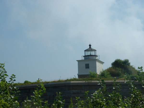
The first light we saw was Clark's Point in New Bedford. It's in this GREAT park, with an old fort and a battery you can walk around in. The only problem is that the light is on TOP of the fort, making photo taking difficult.
You may have already seen this photo, I posted it last week, but am including it for completeness' sake.
At that park, there is a pier that people fish off. After risking your ankles to get to the end, and the ability to see water through the cracks NOT helping, you get this view. When out there, we met some great New Bedforders fishing. A barge passed by with sand on it...one said, "Hey (insert name here), wouldn't you like to take your dirt bike down that?"


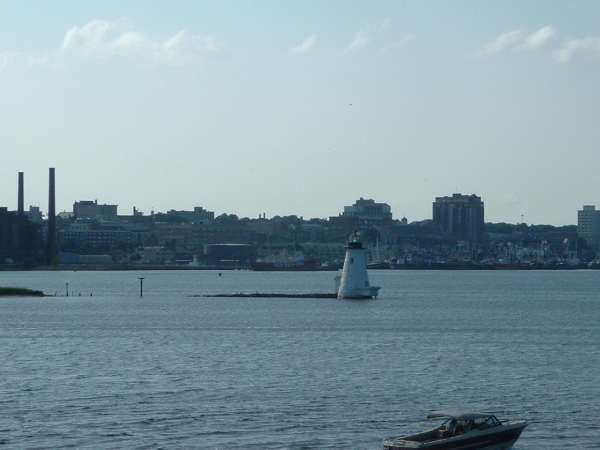
Onward to the next light. We could see Palmer's Island from many places along the road that borders the harbor, but the best views came from the hurricane wall. This looked a bit too deserted. So we went to the other side and...
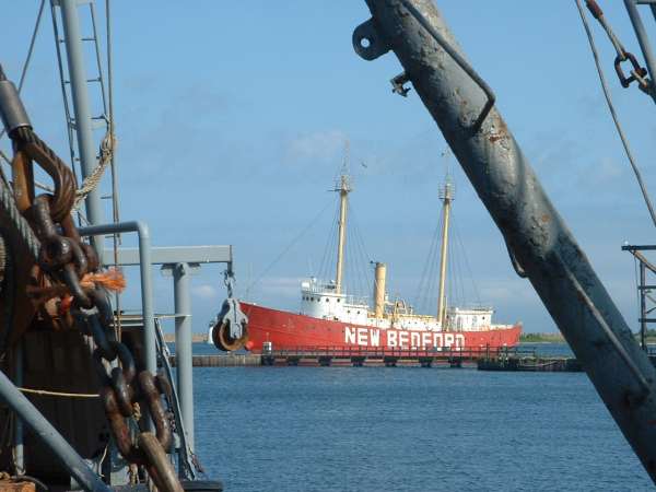
Well, first we saw the LS New Bedford. Neat little lightship...we found a fish plant (an experience that does not neccesarily need to be repeated), and shot some quick shots between boats. I think they came out nice...I like the framing by the ropes, chains, etc.
OK, now back to our scheduled programme. We crossed into Fairhaven, where we would stay for the night. We drove to the OTHER side of the hurricane wall, where there was a lovely little park. We walked along the wall, and got these photos.
Then we stayed for the night in Fairhaven.
The next day, we would see the lights to Nobska. However, stupid me left the directions with the timing home. We wanted to hit two open houses today, and both were over by noon. We planned a zig-zag path. We would start at Bird Island, then go back to Ned's Point for the tours, then all the way to Nobska, cutting that open house close, then backtrack to Wing's Neck.
We started at Bird Island. There was a great golf course right here...I think they did some tournament or something there once. The lighthouse was offshore...very nice!

Then Ned's Point...instead of the traditional view, I'm going to do something a bit different.

It is hard to get good photos with five year olds walking around the light. Good thing we were early, so I could get SOME good photos! :rolleyes:
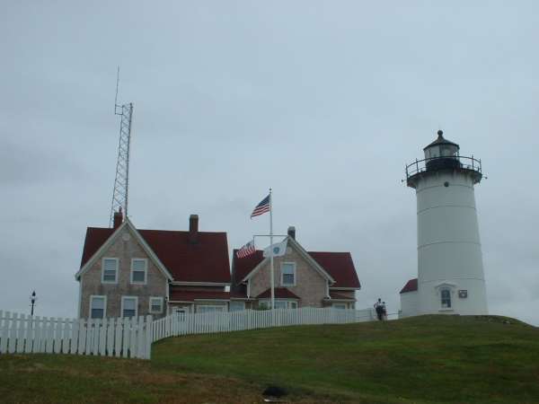
Then on to Nobska, where we got on the last tour of the day...YESSS!! We were one of the last people allowed up!
Finally, Wing's Neck. We drove down the neverending road, and were confronted with the gate of doom. Can you say...TELEPHOTO?


Hope you like them...soon, maybe I can add the rest of the state! Now for the question, why does this software consider smilies IMAGES? I had to disable my little colored guys.


